Goal
After reading this article
you'll
- know how to create a KML layer
- know how to import a KML layer
Summary
KML is an XML-based file format for displaying information in a geographic context.
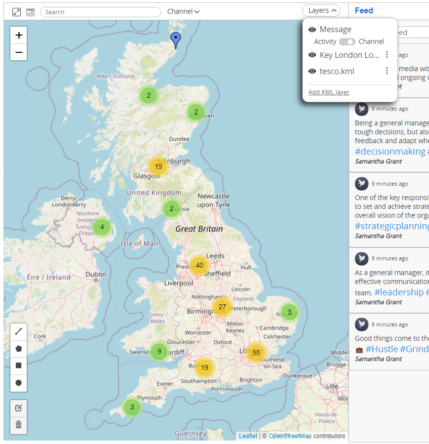
Since KML can be uploaded and placed as a layer, it is a format used in Conducttr for transferring geodata in the InfoMap channel.
| Name | Working with KML layers |
| Benefit | Allows you to overlay points of interest on the InfoMap |
| Features |
|
Creating a KML layer
Creating a KML layer
| 1. Navigate to myMaps | 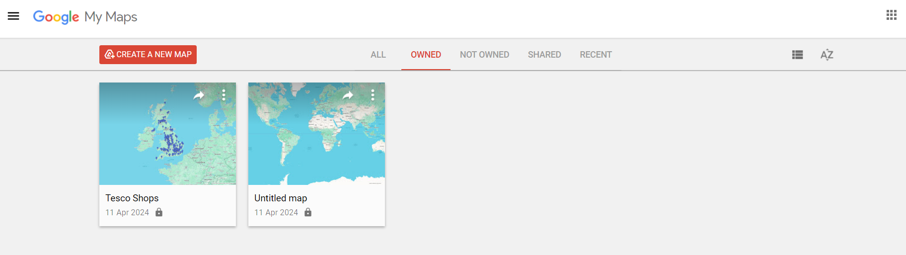 |
| 2. Create a new map | 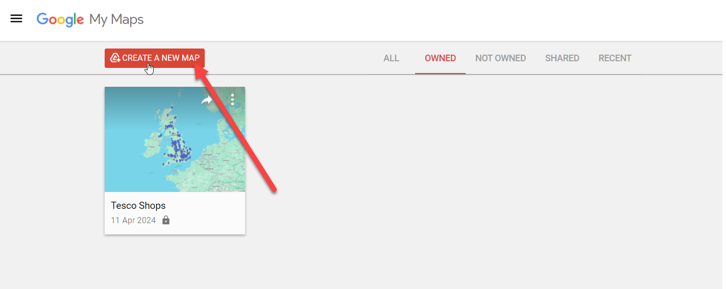 |
| 3. Give your map a title and layer a name | 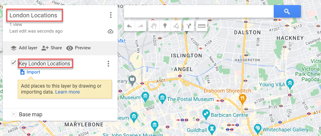 |
| 4. Find your locations by using the search bar at the top | 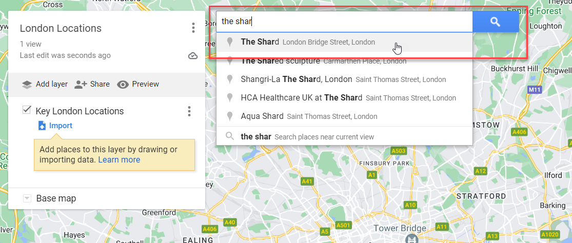 |
| 5. Click the + button to add these locations to your layer |  |
6. Repeat steps 4 &5 with different locations. To differentiate your points you can give them icons and colours by hovering on the locations and clicking on the bucket icon on the right hand side. | 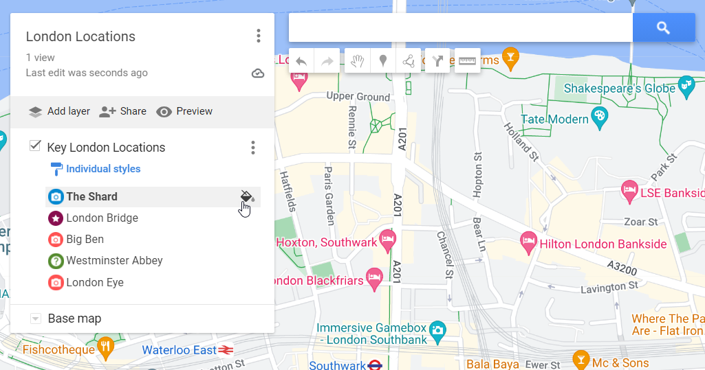 |
7. Export Data: Once you have added all of your locations, export your layer into a KML file. Click on the three dots > Export data > KML/KMZ | 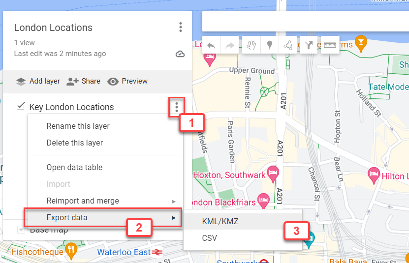 |
| 8. Ensure to tick the bottom box and click download. | 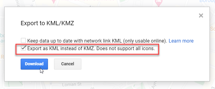 |
Importing a KML Layer
Importing a KML Layer
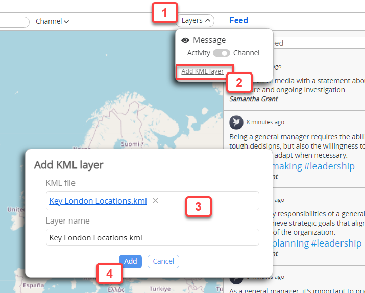
In the player view navigate to Layers > Add KML layer > Attach the KML file > click Add
This layer will now be added to your InfoMap. You can overlay different layers by following the steps above.